In my data science project on Colombia, I analyze demographic data and compare cities and regions across Colombia. By exploring data sets and applying statistical techniques, I uncover valuable insights and trends about population characteristics and distribution.
In this project, I compare the population sizes of different cities and regions, explore the factors that influence population growth, and look at the population distribution across the country.
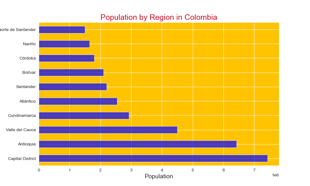
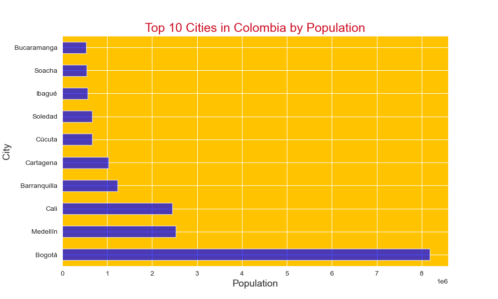
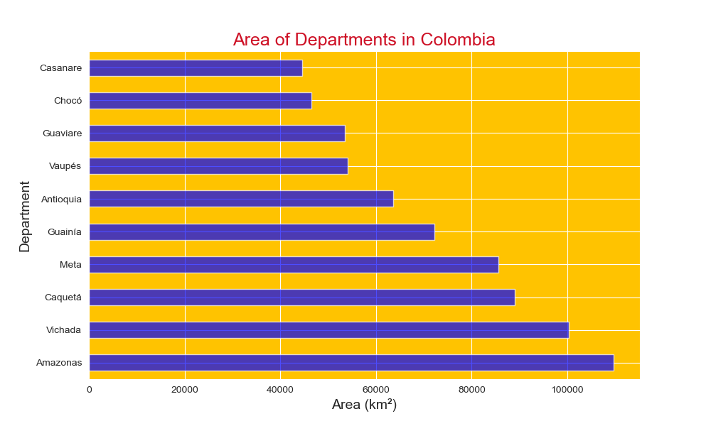
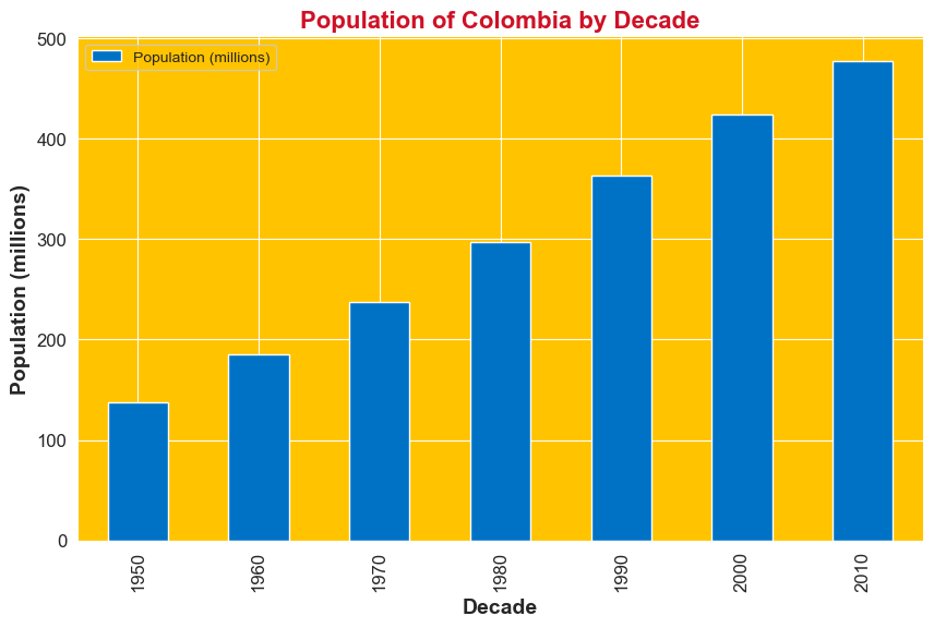
A more detailed analysis that I conducted for Colombia involves looking at differences between states in terms of population, area, and unemployment rate. Explore the three interactive choropleth maps below, zoom in on Colombia, and hover over the states to reveal regional differences in these dimensions. If there is no data, a value of 0 is displayed. The color bar on the right shows the values, with red color representing higher values.